Thứ Sáu, 30 tháng 8, 2013

Vietnam among Top 5 places in the world for women to travel solo

There are many places in the world that I’d recommend such a journey; however, women should still keep some basic safety practices in mind and Vietnam is considerd one of the best places for women to travel solo in the world.
Year round women are seeking trips to venture out on their own, away from daily life and the demands of work, family and friends. They want to forget about wearing make-up, truly be themselves and enjoy the experience of a lifetime. While there are travelers who want the support of a small group, some prefer to go it completely alone.
There are many places in the world that I’d recommend such a journey; however, women should still keep some basic safety practices in mind. I always recommend storing your valuables in different places (hotel safe, your pocket, wallet), keeping a copy of your passport in case it’s lost or stolen and using a moneybelt instead of a purse. Plus, simply appearing confident instead of unsure can go a long way in avoiding danger.
I also suggest when women first arrive at their destination that they take a guided walking tour to get acclimated, to learn where things are and to get a feel for the culture. It’s also important to dress appropriately for the country; conservative is always better and ensures you can gain admittance to attractions that may require a standard of dress.
One of them is Vietnam country where you can freely explore culture, people and scenery by yourself. 
I absolutely love Vietnam and have been there many times. Saigon and Hanoi are both fabulous cities that are safe. Choose a hotel in one of these major hubs and then venture out by day on a bike tour, on a daytrip to see temples, or to visit local museums. You can also take a cooking class, rock climb and try some unusual Vietnam delicacies if you dare!
Other places are Alaska, Iceland, New Zealand, Costa Rica and Panama.

VISITING BO HON ISLAND - ONE OF THE LARGEST IN HA LONG BAY

Being one of the most beautiful and largest islands on Halong Bay, Bo Hon Island is very famous for not only its splendid scenery but also many fascinating grottoes.

It’s actually an island range of linked islets. High lime-stone mountainson Bo Hon Island are featured with vertical cliffs and ever-green forest. From a distance, it looks like a majestic citadel. Besides there is a lof of high mountains, mountains follow closely make a huge beautiful watercolour picture on the sea.

There are many grottoes here such as the Sung Sot (Surprise), Luon, Trinh Nu(Virgin) grotto. Each of them has their own marvellous beauty and is related to the moved legends.

The island is also home to various species of plants such as benjamin fig trees, cycads and orchids... and animals are monkeys, deer and chamois.

Thứ Hai, 26 tháng 8, 2013

My Son site

My Son, located 69 km southwest of Danang, was an imperial city during the Cham dynasty, between the 4th and 12th centuries. My Son Sanctuary is a large complex of religious relics that comprises more than 70 architectural works. They include temples and towers that connect to each other with complicated red brick designs. The main component of the Cham architectural design is the tower, built to reflect the divinity of the king.


According to records on the stone stele, the prime foundation of the ancient My Son architectural complex was a wooden temple to worship the Siva Bhadresvera genie. In the late 16th century, a big fire destroyed the temple. Gradually, historical mysteries were unveiled by scientists. Through stone stele and royal dynasties, they proved My Son to be the most important Holy Land of the Cham people from the late 4th to the 15th centuries. For many centuries, the Cham built Lip, a mutually linked architectural complex, with baked bricks and sandstone. The main temple worships the Linga-Yoni, who represents the capability of invention. Beside the main tower (Kalan) are several sub-towers worshipping Genies or deceased kings. Although time and the wars have destroyed some towers, the remaining sculptural and architectural remnants still reflect the style and history of the art of the Cham people. Their masterpieces mark a glorious time for the architecture and culture of the Cham, as well as of Southeast Asia. 


Each historical period has its own identity, so that each temple worshipping a genie or a king of a different dynasty has its own architectural style full of different impression. All of the Cham towers were built on a quadrate foundation. Each comprises three parts: a solid tower base, representing the world of human beings, the mysterious and sacred tower body, representing the world of spirits, and the tower top built in the shape of a man offering flowers and fruits or of trees, birds, animals, etc., representing things that are close to the spirits and human beings. 

According to many researchers of the ancient Cham towers, the architectural art of the Cham towers at My Son Sanctuary is the convergence of different styles, including the continuity of the ancient style in the 7th-8th centuries, the Hoa Lai style of the 8th-9th centuries, the Dong Duong style from the mid-9th century, the My Son and My Son-Binh Dinh styles, etc. Among the remnants of many architectural sites excavated in 1898,  a 24 metres high tower was found in the Thap Chua area and coded A I by archaeologists and researchers on My Son. This tower is a masterpiece of ancient Cham architecture. It has two doors, one in the east and the other in the west. The tower body is high and delicate with a system of paved pillars;  six sub-towers surround the tower. This two-storey tower looks like a lotus flower. The top of the upper layer is made of sandstone and carved with elephant and I ion designs. In the lower layer, the walls are carved with fairies and water evils and men riding elephants. Unfortunately, the tower was destroyed by US bombs in 1969. 

After the My Son ancient tower complex was discovered, many of its artifacts, especially statues of female dancers and genies worshipped by the Cham people, worship animals and artifacts of the daily communal activities, were collected and displayed at the Cham Architecture Museum in Danang city. Although there are not many remnants left, those that remain display the typical sculptural works of cultural value of the Cham nationality. Furthermore, they are vivid proof, confirming the history of a nationality living within the Vietnamese community boasting of a rich cultural tradition.


The United Nations Educational, Scientific and Cultural Organisation (UNESCO) and the Ministry of Culture and Information will establish a management board for the My Son World Cultural Heritage Site. 

Local and foreign experts working at My Son site reported that their work is running smoothly and they have recently uncovered several more relics. 

My Son is world-renowned for its temple towers and sanctuaries built by the Cham ethnic people for conducting religious rituals. French archaeologist Henri Parmentier discovered the complex in 1898 and classified the temple towers into various groups.

Each group is characterised by a gate tower, a main tower symbolising heaven, a long tower shaped like a house providing lodging for pilgrims, a tower to store materials for worship and smaller towers in honour of the gods of direction and the stars.

In 1999, UNESCO designated My Son and the ancient town of Hoi An world heritage sites two of only 50 such sites in the world. The organisation has offered programmes to help Viet Nam, and Quang Nam Province in particular, protect the sites.

After excavating around the towers in the G group, experts found that laterite is the material used to build the wall around the towers and even some towers. They also discovered two terra-cotta decoration pieces engraved in Han script, which are different from other tower groups in My Son and shows the participation of Viet people in the construction process of My Son. UNESCO and the Ministry of Culture and Information will establish the My Son World Cultural Heritage Site Management Board and boost the archaeological and restoration activities at the site. 

The project to excavate and restore towers in the G group at My Son relic site has been implemented thanks to an agreement signed between the Government, the UNESCO Asia-Pacific office and the Italian Government. 

Admire breathtaking natural landscapes in Bach Ma National Park

Located in Hue Vietnam, Bach Ma National Park is recognized as one of the areas of Indochina with high biodiversity. The typical climate on this Park, which is nearly the same as that on Dalat, Sapa and Tam Dao, is temperate all year round. As a result, many tourists in Vietnam travel are attracted to this National Park where they can admire breathtaking natural landscapes and take part in outdoor activities.
Lying 50 km south of Hue city, Bach Ma National park has a temperate climate much like that of Dalat, Sapa and Tam Dao. However, since it is located so close to the sea, the highest temperature in summer never exceeds 26oC and the temperature in winter never goes below 4oC.
Bach Ma National Park
Thanks to these advantages, the French transformed Bach Ma into a summer resort in the early 1930s. The area comprises 139 villas and auxiliary buildings, such as the post office, bank, tennis court, etc. Unfortunately, the war and lack of maintenance have significantly affected these constructions.
After 10 years of reunification, the State established a network of 87 natural reserves including Bach Ma in 1986. It was officially founded on 15 July 1991.
Coming to this National Park, visitors in Vietnam tourism are attracted to its breath-taking natural landscapes. The highest peak is Hai Vong Dai (Sea Observation Post), 1,450m high, where people can have a panoramic view of the immense sea and surrounding scenery. Do Quyen Waterfall is astounding and huge in the wooded mountain. It is more than 300m high and 20-30m wide. It is amazing to watch the silver water running into the bright red of water-rail flowers. Bac Chi Waterfall, about 20m high, roars all year round. Five lakes - a system of large lakes - has clean and cool water, created by the block of black granite stretching along Kim Qui Spring. This is a good place for camping, bathing, and outdoor activities.
Moreover, Bach Ma National Park is still home to 931 species of animals of which 83 wildlife species, including tigers and monkeys. It also houses 333-odd species of birds known to inhabit Vietnam. More than 1,406 species of plants have also been identified.
Bach Ma National park
Besides an interesting eco-tourism destination to tourists in Vietnam travel, the Bach Ma National Park has an advantage of being close to Vietnam's three world cultural heritage sites (Hue Imperial City, Hoi An Ancient Town and My Son Cham Towers).
Therefore, tourists joining tours in Vietnam usually add the park to their itinerary. With highly-valued natural resources, Bach Ma does not only gratify thousands of visitors but also attract scientists.  The best time to visit Bach Ma is from February to September. It is open from 7 am to 5pm.

Hidden side of ancient Hue

Once those sites have been checked off the list, there is nothing left to see and no need to return. That is the established thinking, anyway.

To me, however, it is very different. I am fascinated by this small and historic city and its surroundings, and I am struck by a great happiness every time I return. There is far more to Hue than meets the eye.

I love the cuisine, the beautiful scenery and the slow pace, and it is easily among one of my favourite destinations.

Located between two cities of Hue and Da Nang, Suoi Voi 
has ancient links with elephants. It is becoming popular with tourists.
My love for Hue has been enriched even more after a recent visit to Suoi Voi (Elephant Spring), which is hidden away in Loc Tien Commune in Phu Loc District. In this place, my friend and I swam in the springs, played in the forest and ate delicious local chicken. It was a wonderful day.

Suoi Voi is about 60km from the centre of Hue, and 40km from Da Nang City. Its location between these two cities makes it a popular pit-stop for people making the journey between the two.

While people call it a spring, it would be more accurate to say that it is a network of pure springs, boulders, mountains and jungle which come together to create a truly stunning landscape.

The journey there is unremarkable, and the road is made of cement. We parked the car when we could go no further and clambered up high steps with some uncertainty. Then the spring appeared.


Tourists cool off in the splendid natural swimming pool in Suoi Voi.
It was breathtaking. Suddenly I became very aware of an incredibly fresh atmosphere caused by the pure and cool pool of water and the green of the surrounding forestry.

Bamboo huts built by local people lined the two sides of the stream, with the water bubbling past creating a natural soundtrack to the idyllic scene.

Visitors here are able to hire a hut, take a rest and enjoy the local cuisine.

We did exactly this, and lay back with our feet dangling into the cool flow of water.

Talking to the hut's owner, I was informed that Suoi Voi was once called Suoi Me (Me Spring – me meaning large elephant in the ancient language).

In spring, she explained while preparing a meal for us, when the weather was warm hundreds of elephants from Bach Ma Mountain would come to the forest and this particular stream to find cassava shrubs and other food.

Oddly, they only came to this one region, and then after some time – just as mysteriously – they left for the last time and never came back.

The elephants left their marks in the shape of large holes surrounding the spring, which over time filled with water to become small pools.

These are clear and cool and instantly attractive to visitors who want to jump in and swim as soon as seeing them. Signposts clearly label which ones are safe for them to do so.

My friend, who comes from northern region of Viet Nam, said that he has visited many places like Suoi Voi in the north, such as Suoi Tien, Khoang Sanh and Ao Vua, but he loved this experience the most.

"They all have the combination of natural fountains, forests, and rocks, but the ones in the north are less beautiful.

Here it is clean and safe for swimming," he said.

To make absolutely sure we were safe, my friend hired a lifebuoy to swim for just VND10,000.

Suoi Voi soon proved to be an equally perfect destination for sunbathing, with visitors tired from their swim able to rest at full stretch on the large rocks to enjoy the sun as it radiated through the canopy of trees above.

While my friend swam, I took the chance to gaze out at the surrounding landscape.

I noticed a big rock shaped like an elephant with a long trunk, and the hut's owner told me that it was artificial, made to memorise the real elephants that gave the site its name.

This elephant marks the nearby Elephant Lagoon, which is perhaps the most beautiful pool as it lies between two waterfalls and is completely translucent.

The hut's owner suggested that I explore further inside the forest – packed with rare animals and plants – in order to discover more beautiful hidden scenes and enjoy many new experiences such as fishing in some pools and picking local vegetable to cook soup. I wholeheartedly approved of this idea, and went for a long walk.

I think that Suoi Voi is a special place not just for its natural beauty but also for the things that it brings to the local people.

Since first opened as a tourist destination in 1994, it has brought jobs to many residents, despite only being open throughout the summer. It is estimated that each household can earn about VND12-15 million (US$600-750) per season from offering services to visitors.

At the end of the day – capped off with a delicious chicken noodle dish – I was extremely reluctant to leave. It had been a truly memorable experience, and one that I am sure I will relive in the future. For me, the beauty and cuisine of Hue and its surroundings are sure to entice me back again and again.

The Citadel of Hue City

he Citadel Complex of Hue, set up by Nguyen Dynasty from 1805 to 1945, is now one amongst the relics of the Hue ancient Capital – theWorld Cultural Heritage, capturing much of tourists’ attention.

The poetic and beautiful Hue of Vietnam was chosen to be the capital of the Southern Kingdom under Nguyen Lords’ Dynasty, and officially became the nation's capital under Tay Son Dynasty, King Quang Trung. The citadel palace complex is located on the North bank of Huong River (Perfume River), inside Hue city. It is a huge complex covering an area of 520ha and comprising three circles of ramparts, Kinh Thanh Hue (Hue Capital Citadel), Hoang Thanh (Royal Citadel) and Tu Cam Thanh (Forbidden Citadel). It was said to be protected by the two sand dunes: The Con Hen and Con Da Vien on the Perfume River, as "dragon on the left, tiger on the right". If you are in Hue, please join us in this small journey exploring the beautiful feudal palace, the inspiration for numerous artists ever stepping inside!

The very first stop-over is the exterior circle, the Kinh Thanh Hue (Hue capital citadel), which started to be constructed in 1805 under the reign of Emperor Gia Long and was completed in 1832 under the sovereignty of Emperor Ming Mang. Over the past 200 years, it has still maintained original with nearly 140 small and large constructions. With a square shape, it is almost 10km in circumference, 6m high, 21m thick, with 10 entrances. On the top of the walls, 24 bastions are established for defensive purposes. Besides, the Citadel has an ancillary gate connecting the Tran Binh Bastion called the Tran Binh Mon (Peaceful protector Gate).
Now we get further into the second circle, the Hoang Thanh (Royal citadel), also the most important part of the Citadel, which was built in 1804 but totally completed in 1833, under King Ming Mang’s reign. The Citadel, which is more than 600m long for each side, was built with bricks of 4m high, and 1m thick. Around the citadel is a protecting trench system. Tourists can get access to the Imperial Citadel through four entrance gates. In the past, Ngo Mon Gate was only reserved for the King. Royal Citadel consists of more than 100 fascinating architectural works divided into numerous sections:
  • Section of the Ngo Mon Gate and the Thai Hoa Palace: used for various grand ceremonies. 
  • Section for placing shrines of the Kings under Nguyen Dynasty: Trieu Mieu, Thai Mieu, Hung Mieu, The Mieu and Phung Tien Temples.
  • Section of internal affairs office: Storehouse for precious objects, workshop for manufacturing various useful articles.
  • Section of the Kham Van Palace and Co Ha Garden: is where the princes studied or relaxed.
Passing through Hoang Thanh, we enter Tu Cam Thanh (Forbidden Citadel). Situated inside the Imperial Citadel complex, behind the Throne Palace, the Purple Forbidden Citadel was reserved for Emperor and his family. Built in the early 1803 under reign of Emperor Gia Long, it was initially named Cung Thanh. In 1821, it was renamed into the today’s Tu Cam Thanh. 

This citadel part was built with brick walls of 3.72m high, 0.72m thick, and about 1,230m in circumference. Its front and back sides are 324m long respectively, while the left and right sides are both more than 290m long. The whole site consists of 50 architectural constructions of different sizes and 7 gates for facilitating the entrance and exit. Dai Cung Mon (the Great Palace Gate) is in the front side, only reserved for the Kings. Can Chanh Palace was the place for daily working of Emperors. Can Thanh (Emperor's Private Palace), Khon Thai Residence (Queen's Private Apartment) were reserved for the Queens. There are still many other sections, for instance, Duyet Thi Duong house (Royal Theatre), Thuong Thien (the kitchen for the Kings' food), Thai Binh Lau (King's reading room), all of which are of great architectural value, luring uncountable visitors who are interested in feudal architecture.
Should you ever come inside the citadel, taking a look into the special feudal relics of immense architectural and cultural values, you will surely more or less love the traditional and classical side of Vietnam. As time goes by, thousands of changes have occurred, the precious historical and classical beauty of the nation would never be gone!
Other tourist activities:
  • Xa Tac pavilion
  • Flag tower
  • The Hue National University
  • Hue royal imperial fine art galary
  • Bookstore palace
Standing for over 200 years and consisting of over 100 fascinating architectural works almost remained unchanged, the Royal Citadel is an ideal place for those wishing to better understand an architectural and cultural beauty as well as an important history of Vietnam. Joining a city tour and visiting Hue Citadel - the not-to-be-missed attraction when you travel to Hue will give you a better understanding of the architectural and cultural beauty during an important phase in Vietnam history. 

Thứ Năm, 22 tháng 8, 2013

Nha Trang beach

Nha Trang a small town in Vietnam, located in the Khanh Hoa province is widely recognized because of it gorgeous beaches. In fact Nha Trang is often referred to as the ‘Seaside Resort’ of Vietnam. Having vast tranquil beaches and the finest climatic conditions, the Nha Trang Beaches, Vietnam are perfect for a lovely holiday.


Of the 6 major Nha Trang Beaches in Vietnam, Tran Phu is the most popular one. It is one of the most activity filled of the various Nha Trang beaches. It is also has the Tran Phu Street running parallel to the beach for its entire span, which is a beautiful avenue adorned with a lush green centre and pretty street lamps. Many key hotels, eateries and bars are lined along the street. Being the most frequented one the Tran Phu Beach is also the most crowed of all the Nha Trang beaches.


The other Nha Trang beaches, Vietnam though less popular than Tran Phu are perhaps lovelier and more soothing. The Northern part of Nha Trang and some of its islands flaunt beaches like Hong Chong beach and Dai Lanh Beach. With lovely scenic beauty these beaches are amongst the finest beaches in Vietnam and are surely a treat for the eye.


Apart from unwinding yourself in the midst of nature, you can also indulge yourself in some of the various outdoor activities that the Nha Trang Beaches, Vietnam has to offer. Here you can go for a swim in the sea, play football or badminton, perform Tai Chi, a kind of Chinese meditation popular in Vietnam and many other activities. Sun bathing is another favorite pastime popular among the tourists. The Nha Trang Beaches in Vietnam also invites long leisurely walks. It is no wonder that the Nha Trang beaches, Vietnam are recognized as the most frequented of the Vietnam popular destinations.

Perfume River (Hương River)


The romantic Perfume River
A visitor to Hue once remarked after his vacation here: “A visit to Hue would not be complete without a boat excursion on the gentle Perfume River, or else you cannot feel the romance of Hue”.ThePerfume River (Vietnamese: Sông Hương or Hương Giang) is a river that crosses the capital city of Hue, in the central Vietnamese province of Thua Thien Hue. Perfume or Huong River is around 80 kilometers long, and owes its name to the fact that it flows through many forests of aromatic plants before reaching Hue, bringing with it a pure and fresh aroma.
Source and flow
The Perfume River has two sources, both of which begin in the Truong Son Mountain range and meet at Bang Lang Fork. The Ta Trach (Left Tributary) originates in the Truong Dong mountains and flows northwest towards Bang Lang Fork. The shorter Huu Trach (Right Tributary) flows through the Tuan ferry, landing towards Bang Lang Fork.
Then it flows in south-north direction passing the temples of Hon Chen and Ngoc Tran, and  turns north-west, meandering through the Nguyet Bieu and Luong Quan plains. From this, the River then continuously flows int the north-east direction to Hue city, only an echo of Truong Son mountain, and passes the rest place of the Nguyen Emperors. The river of green water continues its itinerary, passing Hen Islet and various villages, crossing the Sinh junction, which is known as the capital of ancient Chau Hoa, before emptying into the Tam Giang Lagoon.
From Bang Lang to Thuan An estuary, the Perfume River is 30 km long and runs very slowly (as the river level is not much above sea level). The Perfume River darkens as it winds along the foot of Ngoc Tran Mountain - home of the Jade Cup Temple - where there is a very deep abyss.
Artist inspiration
The poetic romantic Perfume River is the deep inspirations to numerous artists, poets, and composers;
                                                 "Who turns to Hue
                                                  Who comes back to Ngu Mount
                                                  Who comes back to Huong River
                                                  The river water never sinks
                                                  Ngu Mount birds fly back to friends
                                                  Whoever are children of Hue remember to return…”
are the beautiful lyrics of a famous song, “Who comes to Hue”, written by Duy Khanh. In the autumn, flowers from orchards upriver from Hue fall into the water, giving the river a perfume-like aroma, and a beautiful poetic view. I have asked several artists about the reason for their inspiring love for Perfume River, and received nearly the same answer: “Well, my inspiration derives from the pure water, the fascinating landscape, and the gentle bridge over the river”.
Today, travellers coming to Hue could not miss a while of boating along the river. Most of them admit that this is one of the most beautiful and extremely splendid riverside landscape (especially at night when lights are on) that they have ever visited!
A river tour

Perfume River at night

As mentioned, the river flows through a series of beauty-spots, taking visitors to every corner of the ancient citadel when you travel by boat. Along the river, you can visit Da Vien, Phu Xuan, and Truong Tien Bridges, come to the Tomb of Minh Mang, Hon Chen Shrine, Thien Mu Pagoda, and finally to bathe in the sea. Upstream, at the Tomb of Thien Tho, you can hear the rustling of the pine tree, which may help you become a… poet!
When the night comes, the surface of the river glistens under the moonlight, and the songs of the boat rowers can be heard breaking the silence. Just come here and you will feel the pure atmosphere of romance and beauty!
As one of the most popular attractions in this romantic city, a boat ride or cruise on the Huong River in Hue is included in a lot of classic Hue city tours or day trips. Pick the most suitable itinerary for you and start exploring the beauty of this poetic river and city today!

Phu Quoc - Pearl Island

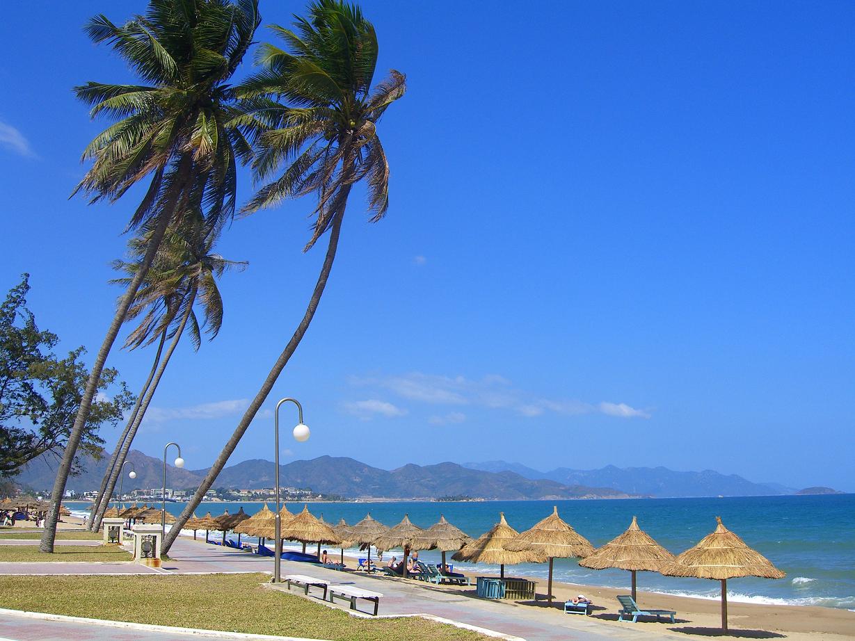
It's really a peaceful tropical paradise with turquoise waters, untouched natural environment, relaxed atmosphere, friendly locals...
Phu Quoc is an almost unknown destination in Vietnam Tourism. International tourists and Vietnamese alike just recently discovered Phu Quoc. It is not hard to see why many travelers in Vietnam travel are boasting of the splendid natural beauty and untouched remote beaches of this spectacular tropical island. 

Surrounded by more than 40 km of white beaches decorated with coconut palms, Phu Quoc, situated in the Gulf of Thailand near the Cambodian border, is Vietnam’s largest island.  It is closer to Cambodia than the closest mainland town of Ha Tien in Vietnam in the Kien Giang province, which is 46 km away. Its western coastline is sparsely populated while the interior is largely covered with jungle and mainly deserted. 
Although Phu Quoc is a new holiday destination, in the first quarter of 2007, about 50,000 visitors came to the island of which 50 per cent were foreign tourists.  According to new targets released by the Government, Phu Quoc is aiming to attract 2-3 million visitors annually by 2020, with a larger portion of foreign tourists.


Phu Quoc is blessed with favourable natural environment like the virgin forest of over 37,000 hectares, white sandy beaches, coral gardens offshore, varieties of wildlife species, so it is not hard to see why the island has great tourist potential. The government has formed a master plan to develop the island into a high quality eco-tourism destination by 2020. As investment starts to flow into Vietnam, the Island will slowly undergoing development and improved infrastructure. The Prime Minister has offered the best preferences possible for domestic and foreign investors to allow development of the Island, leading to an international standard tourist and trade centre by 2010 through to 2020. 

In the third quarter of 2008, officials plan to start construction on an 800 hectare international airport that can accommodate large passenger jets and link the island with major regional hubs (e.g., Singapore, Thailand, China, Japan, Hong Kong, etc).
Tourists in  Vietnam travel can start exploring the island in Duong Dong, the biggest town on the island (west of Phu Quoc), where most of hotels and resorts are located. Going south, you can drive along Bai Truong (Long Beach), which is a 20 km long, spectacular beach. You will see two pearl farms on the right, the second is worth a visit. At the end of the road turn left (you can’t miss it) and follow the signs, you will reach the fisherman village An Thoi and the An Thoi pier, the island’s southern tip. From here the An Thoi Islands, a very nice snorkelling and diving area consisting of 15 small islands and islets surrounded by coral reefs in crystal clear water, can be visited by boat. 
Continuing to travel north-east, tourists in  Vietnam travel will see a sign to Bai Sao Beach (the sign is somewhat hidden, around 1 km away from the main road). Bai Sao Beach, with its marvelous white sand and green-turquoise water, is one of the most beautiful, quite untouched beaches on Phú Quốc Island. There are a number of simple, on-the-sand restaurants with tasty, fresh seafood in this area. 
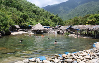
Before going back to Duong Dong, there are some recommendable springs and falls: Tranh Stream and Da Ban Stream. Tranh Stream (some 10 km north of Bai Sao Beach) is a stream connecting tiny ponds at different levels through small waterfalls. Da Ban Stream (a stony surface stream, north-east of DDuong Dong) is an easily accessible white-water creek, gracefully flowing down huge granite boulders, on which you can wake; in some places there are natural pools waiting for a refreshing swim.
A stay on Phu Quoc Island would not be complete without visiting one of the factories producing fish sauce, one of the most popular ingredients of the Vietnamese cooking as well as one of the pearl farms with panels describing the formation of pearls and shops selling pearl jewellery.
This island has a unique species of dogs, the Phu Quoc Ridgeback, which has a ridge of hair that runs along its back in the opposite direction to the rest of the coat. Much of this island’s nature is still protected. Around 70% of the island, an area of 31,422 hectares, became a national park in 2001. The rainy season on Phu Quoc is from July to November and the peak season for tourism is midwinter, when the sky is blue and the sea is calm.
If  tourists Vietnam travel like untouched nature and pre-touristic surrounding, don't hesitate traveling to Phu Quoc! 

Thứ Tư, 14 tháng 8, 2013

Visting Dinh Cau (Cau Temple)

Located in the mouth of Duong Dong River, Dinh Cau (Cau Temple) is considered the symbol of culture and religion in Phu Quoc island where sand, sea, sun, and stone blend in a perfect harmony.
Dinh Cau is a place for good luck, welfare, and a fishing voyage being full of fishes.

Many tourists are attracted by the fascinating beauty of Dinh Cau rock but also mystery and supernaturalness of ancient legends.

According to the elders here, Dinh Cau has existed for a very long time.


Formerly,  Phu quoc people mainly earn their living by fishing, many fishmen met storm offshore and never returned. One day, there was a cliff suddenly appearing among the sea. Local people thought it was an omen so they built a shrine in the cliff among the sea. Before going out to sea, local people burn incense to pray for safe and sound.


After climbing 29 stone steps to the shrine, tourists will have a chance to contemplate masterpieces of ancient architecture and precious artifacts associated with the history of the island. In addition, tourists can feel the gentle sea breeze, watch sunset over the eroded rock formation and enjoy a peaceful view of the Duong Dong River.


The islanders and seafarers annually visit to the temple on the big and Lunar New Year holidays. Especially, the local festival days are based on the lunar calendar and fall on Oct. 15 and 16. Therefore, the temple becomes a great attraction for tourists in their trip to Phu Quoc Island.


Thứ Sáu, 9 tháng 8, 2013

Trang An eco-tourism site

Located in the centre of the province of Ninh Binh, 80 km from the city of Hanoi to the south, Trang An is a complex of scenic landscapes and historical and cultural heritages.
Trang An boasts a system of adjoining limestone mountains and valleys belonging to the ancient ocean branch of the Tethys from China into Vietnam, on an area of around 10,000 ha, including three areas: Trang An eco-tourism site, Tam Coc – Bich Dong tourism site and Hoa Lu Ancient Capital cultural and historical heritage site.
Trang An complex is often referred to as a “Halong Bay on land”, but few people know that only a few thousand years also there existed an ancient bay demonstrated by the water marks on the limestone cliffs, vestiges of oysters on them, abrasion terraces, and marine sediments of the Quaternary period.

Trang An is also a tropical karst landscape with a humid monsoon climate, and witnessed a lot of sea invasions and transformations similar to Halong Bay; its karst landscape are terrestrial, concentrated on a smaller area, and regular in variety of shapes and sizes.

The landscape is replete with tower shaped karst along the fringe of a block of limestone islands with flat peaks of varying styles. The karst islands are widely scattered among incoherent flat fields and, in season, neighbor to a sea of golden grain.

These cone shapes of different sizes seem to be floating, scattered and unconnected on the even and flat rice fields, filed with the color of ripen rice. The karst landscape, with a pyramid shape in the middle, connects the sharp pointed peaks into a chain with vertical cliffs enclosing deep valleys in an isometric or linear form.
llustrative image. (Photo: Internet)
Trang An is made up of a complex of scenic landscapes and has intricate and diversified ecosystems, particularly as a cradle of the prehistoric people.

All these factors have made a scenic landscapes complex of Trang An to have outstanding and distinctive values terms of landscape, geomorphology, geology, and culture.

Values in terms of landscape and karst geomorphology:

Trang An has many types of distinctive and unique karst landscape: “remaining karst hills separated from the plains”, “peaks connecting valleys”, “peaks connecting sinkholes”, “tropical karst submerged by the sea”.

No where else in the world is there a landscape similar to Halong Bay but fossilized on land like in Trang An.

No where else in the world is the karst terrain shaped like a narrow wall with sloped skeleton walls extending into an arch enclosing a large, empty space inside like that in Trang An – the rock capital city.

Geological and geomorphologic values:

Trang An, Ninh Binh is located in an area full of historical geological upheavals: bearing unique characteristics in terms of structure and tectonics in the style of a “broken rice pancake”.

Trang An is characterized by a “meshy” network of young isometric non-pronous sinkholes.

The long and wide valley connected with the aged plains in the Southeast parts of the Trang An limestone block is characteristic: They become narrower toward the northwest and extends toward the southeast.

The typical “pulse” neotectonic movements lead to the formation of a “surface balance valley” and “front mountain balance surface.” The three floors of the cave area 10m – 20m, 20m – 30m and 40m – 60m.

Cultural values:

Recently scientists from the Cambridge University (the UK) and the Vietnam Archaeology Institute conducted surveys, research and eight archaeological excavations at Nui Tuong Cave, Oc Cave, vang stone roof, Ong Hay stone roof, Cho stone roof, Trong Cave, Boi Cave and five relics at Hang Pagoda.

The results included many working tools, pottery, and food remains of the ancient people such as animal bones, shells of species of mollusks and crustaceans.

Especially, excavations found human remains in three of six locations. Based on the results of the research, scientists at home and abroad have put forward some initial assessment of the value of the prehistoric culture of the Trang An region.
Trang An pre-historic relics are concentrated in high density, forming different groups in the swampy and follow karst valley. Scientists discovered a relatively intact cultural layer from 1.0m – 2.0m thick, reflecting one or two periods, before, during or after the middle Holocene marine transgression.

The tradition of manipulating limestone objects and using of chiseling tools made from limestone was long maintained.

Pottery appeared early, and was homogeneous in material, pattern, and type among the relics and stayed stable and unified during the long history of the culture of the swampy and hollow valley.

Permanent settlements took place in the caves (2,300 – 3,000 years ago), affected by changing karst valley landscape environment, caused by marine transgression and recession.

Assorted livelihoods were evident along a wide spectrum, with gathering overrunning hunting, planting outdoing animal husbandry, and adaptations to the natural environment.

Trang An landscapes complex boasts outstanding, fascinating and unique values in terms of natural landscapes and preserves the vestiges of natural history, cultural imprints, and many remains of outstanding traditional cultural values of the local communities that are being promoted and conserved.

Thai Vy Temple- A unique combination of architectural design

Following the internal attack with outside support (noi cong, ngoai quoc) architecture, Thai Vy Temple was built during Tran Dynasty, in order to worship for generations of Kings Tran. Coming there, visitors in Vietnam tourism will get the chance to visit beautiful landscapes and to commemorate the merits of King Tran.
Located to the West of Van Lam Hamlet, Ninh Hai Commune, Hoa Lu District, Ninh Binh Province, Thai Vy Temple was built to worship four generations of Kings Tran, Tran Thai Tong, Tran Thanh Tong, Tran Nhan Tong, and Tran Anh Tong.
According to the history, Thai Vy Temple was built during Tran Dynasty  follow the internal attack with outside support (noi cong, ngoai quoc) architecture.
Thai Vy Temple- A unique combination of architectural design
Thai Vy Temple- Hoa Lu- Ninh Binh Province

In front of the temple is Ngoc Well by green stone with clear and full water all the year round. Behind the temple is Cam Son Mountains with rank trees.
Entering into the temple, at triumphal arch (nghi mon) there are two green stone monolithic horses. Passing the nghi mon, 2-storey iron wood bell-tower with eight-roof of mui hai tile is on the right. Corners of the bell-tower roof are very bend like the tail of phoenix. The bell inside was cast in 1689.

Interior temple with spacious worship rooms are decorated very meticulous. Many stone pillars in round or square are carved on with parallel sentences and many shapes such as dragons, phoenixes, unicorn, turtle and the image of cam, ky, thi, hoa (music, chess, poetry, painting - regarded as the four amusements or accomplishments of a feudal intellectual).
In the sanctum, statue of King Tran Thanh Tong (the first-born child of King Tran Thai Tong) is between statues of his parents (King Tran Thai Tong and Queen Thuan Thien). Besides, the votive tablet of King Tran Nhan Tong (the first-born child of King Tran Thanh Tong) and the votive tablet of King Tran Anh Tong (the first-born child of King Tran Nhan Tong) is worship here.
Thai Vy Temple- A unique combination of architectural design
Thai Vy Temple- Hoa Lu - Ninh Binh Province
Every year, Thai Vy Temple Festival takes place on the 14th day of the 3rdlunar month. There are activities such as palanquin procession, sacrifice ceremony, human chess playing, wrestling contest, dragon dancing and boat rowing, etc.
Participating Thai Vy Temple Festival, pilgrims and visitors in Vietnam travel will have a chance to visit scenic spots here, watch the mountains, vast clouds of water, also get the chance to drop in the wind that worries secular to the direction of the source, and to commemorate the merits of King Tran.

Thứ Ba, 6 tháng 8, 2013

Lung Cu flagpole - spectacular scenic in Ha Giang

Located about 24km from the centre of Dong Van district, is a tourist destination that is meaningful for domestic visitors. Being known as “a high forehead of the motherland” where marks the extreme North of our country, Lung Cu is an interesting place for those who love learn history. From its top, visitors can see the whole of beautiful and spectacular landscape.
Just over 400km from Hanoi following National Highway 2 and 4C, the rocky plateau of Dong Van  with mountain paths like blood vessels sticking to the land standing between them and the summit of Lung Cu awaits visitor.
The Lung Cu flagpole, marking the country’s extreme north, is a popular tourist destination that inspires a deep sense of pride in Vietnamese. From a distance, Lung Cu is a spectacular sight with the view dominated by giant boulders and the national flag flying above Dragon Mountain, all set to the backdrop of magnificent forests.
Lung Cu flagpole locates in longitude of 1580 58’, 21’’ west and latitude of 230 21’48, 76’’ North. Its height is 1468.73 m – north pole, the border area of nation. Its design is an imitation of the Hanoi Flag Tower, with eight bronze drums guarding the sides of the octagonal tower. The national flag adorning the top of the 135-stair tower has an area of 54m², symbolizing the unity of Vietnam’s 54 ethnic groups. The road to Ha Giang is like a challenge with visitors and driver. However, coming to Ha Giang few people skip the arch roads leading to the Lung Cu flagpole. It is about 24 kms from center of Dong Van to Lung Cu. 24-km road is a constant series of mountains lying close together. One side of flimsy road is a gut and another side is a high mountain. The mountain pass is sinuous, which gives a trial to every driver.
The road to Lung Cu is beautiful like a watercolor painting. The paddy fields and earthen-walled houses dot the sumptuous panorama. At sunset, Lung Cu village is very peaceful with smoke from roofs and children drive the herd of buffalos to the houses. The cold weather covers on children faces and their hair. The smoke spreads out and makes a corner of the dusk warmer. The road to Lung Cu flagpole has been rebuilt with stair structure helping travelling easier. The higher, the perfect Lung Cu scenery is. See towards 4 sides, Lung Cu village is quiet in the light yellow sunset. Seeing more, you will be more charmed.
 On the Lung Cu flagpole, the red nation flag is flying flutteringly in the winter wind. Be quiet to see the red nation flag with yellow stars, it is certain that visitors will feel peacefulness in your soul and am proud of putting feet on the scared and charming land and touching the flagpole in the border area of nation.

Thứ Sáu, 2 tháng 8, 2013

Visiting Tan Trao Historic Site to learn the August 1945 Revolution

Tan Trao, a small valley lying between mountains and jungles in Son Duong District, 40 km from Tuyen Quang Town and 200km from Hanoi, is a historical area - a resistance base before the August 1945 Revolution.
Tan Trao used to be the revolutionary base of Vietnam before the August 1945 Revolution. Today, Tan Trao is not only a historical area but is an attractive destination of Tuyen Quang for tourists in Vietnam travel as well.  
In fact, Tan Trao is a complex of Tan Trao Communal House, Hong Thai Communal House, and a small jungle which used to be living place of Uncle Ho from June to August 1945. Tan Trao used to be a base for resistance before the August 1945 Revolution. It was also place for organizing the National Assembly on August 1945. That period was bearing time of the great policies of Viet Minh as well as a temporary government which was led by President Ho Chi Minh.
At other aspect, Tan Trao is just a small pretty valley which is situated in the area between mountains and jungles in Son Duong District. It is about 40km from Tuyen Quang City and 200km from Hanoi Capital. In order to reach Tan Trao historic site, visitors only need to travel for 80km from Hanoi on National Highway 3 to arrive Thai Nguyen. Next, you continue to travel for 10km to reach Bo Dau. After that, turn left along Highway 37 and travel for more 45km to arrive Son Duong. Finally, turn right for 16km you will reach Tan Trao Historical Site.

The row of romantic bamboo on the way to Na Lua shack house
Coming to Tan Trao, visitors should pay a visit Na Lua shack house where President Ho Chi Minh presented the pledge to win national independence before the national congress.

Na Lua shack house where President Ho Chi Minh lived and worked
This is a small shack house on the mountainside of Na Lua, about 1km from Tan Lap village to the East. Here, on June 4, 1945, President Ho Chi Minh summoned Congress to strengthen the base of revolutionary and established the Liberation Army to prepare for national conference of the Vietnamese Party and Congress.
Other place you should get to is Tan Trao communal house  where on 16-17 August 1945 the National Congress adopted the decision on the general uprising to seize power across the country.

Tan Trao Communal House
In conclusion, Tan Trao Historical Site is an ideal destination for those who like to discover historic sites as well as learn more about history of Vietnam.